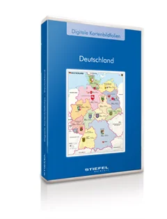
Admisitrative Maps Germany from STIEFEL
Administrative Maps Germany from STIEFEL
digital map picture book about the Austro-Hungarian monarchy
Program is only available in German language
The programme "Basic Knowledge Solar System" step by step familiarises pupils with an elementary knowledge of the structure and functionality of our solar system. Themes like solar and lunar eclipse, day and night and the origin of the seasons are well and carefully explained and illustrated with pictures and drawings, including interactive training exercises. With these, pupils can easily practice their knowledge and discover the solar system – either by t... More
This interactive educational CD contains thematically different maps of the world and of the continents. Teachers and pupils can select groups of information in a targeted way and fade them in and out. In addition to playful activities for training geographic knowledge, interactive exercises make it easier to estimate spatial dimensions and to understand geographical terms.
Basics of Germany content several topics concerning the configuration and structure of Germany. Teachers and pupils can select special information and switch it on or off. The geographical knowledge is trained with playful exercises, which facilitate the rating of dimensions and the allocation of geographical terms.
Most important information about the large religions of the world. Very easy to understand and to use for active and interactive training.
This package includes several thematic maps of Germany for presentation and orientation. All pictures are optimised for presentation with beamers on interactive large format boards as well as they can be used for common use on similar PC-Systems. The pictures can be enlarged and printed. All map pictures are available without text and without text in a black and white reduced picture, if it should be printed for a practise papersheet work, for example.
Different digital mappictures from Europe, with or without Text on the maps. The wall maps are expedient for screen, beamer or boardpresentations. It is possible to enlarge and print the map pictures.
several digital Wallmaps of the World for work and presentation with monitors and beamers. maps can be enlarged and printed. for own map work, maps can be shown wiithout text inside with colours as well as in black and white style.
Dig. Kartenbildfolie: Orient und Okzident
Die Viererkarte: " Nordrhein-Westfalen in Deutschland, Europa und der Welt" als übersichtliches digitales Kartenbilderbuch zum Durchblättern, Seite für Seite. Aufgrund der hohen Bildqualität hervorragend zur Präsentation über Beamer an Whiteboards geeignet, unterstützt Sie dieses Produkt effektiv bei der Erarbeitung des Themas im Unterricht.