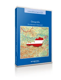
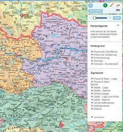
Basic facts about Austria
Program is only available in German language
Basics of Germany content several topics concerning the configuration and structure of Germany. Teachers and pupils can select special information and switch it on or off. The geographical knowledge is trained with playful exercises, which facilitate the rating of dimensions and the allocation of geographical terms.
Most important information about the large religions of the world. Very easy to understand and to use for active and interactive training.
Dieses Lehrprogramm behandelt das Thema Auge und seine Funktionen auf fächer- und jahrgangsübergreifende Weise. Die Kombination von umfangreich bebilderten Präsentationen mit einblendbaren Textinformationen und Animationen, Videosequenzen und interaktiven Übungsformen ermöglicht eine abwechslungsreiche und lebendige Unterrichtsgestaltung. Gestalten Sie Ihren Unterricht individuell und ohne großen Zeitaufwand und binden Sie die Schüler aktiv ein – das g... More
This package includes several thematic maps of Germany for presentation and orientation. All pictures are optimised for presentation with beamers on interactive large format boards as well as they can be used for common use on similar PC-Systems. The pictures can be enlarged and printed. All map pictures are available without text and without text in a black and white reduced picture, if it should be printed for a practise papersheet work, for example.
Different digital mappictures from Europe, with or without Text on the maps. The wall maps are expedient for screen, beamer or boardpresentations. It is possible to enlarge and print the map pictures.
several digital Wallmaps of the World for work and presentation with monitors and beamers. maps can be enlarged and printed. for own map work, maps can be shown wiithout text inside with colours as well as in black and white style.
Die Wandkarte: "Entwicklung der Menschheit" als digitales Bilderbuch, zum Durchblättern. Aufgrund der hohen Bildqualität auch hervorragend zur Präsentation über Beamer an Whiteboards geeignet, unterstützt Sie dieses Produkt hervorragend bei der Erarbeitung des Themas im Unterricht.
With the learning CD "Active: From Reality to Maps" pupils step by step achieve routine in handling maps. Besides interactive exercises with which the orientation in aerial views and maps can be practiced, videos and flash animations make it possible to learn the measuring of directions and distances as well as the identification of objects in space in a colourful and vivid way.
Grundwissen Deutschland beinhaltet unterschiedliche Themengebiete zu Aufbau und Struktur Deutschlands. Lehrkräfte und Schüler können gezielt Informationsgruppen auswählen und diese ein- und ausblenden. Die spielerischen Aufgaben, mit denen das geographische Wissen trainiert wird, erleichtern das Einschätzen räumlicher Dimensionen und das Zuordnen geograph... More
Gesamtösterreich und alle Bundesländer basierend auf bewährten Schulwandkarten zur Vermitltung geographischen Grundwissens über Österreich
Landkreis Rosenheim, digitale Schulwandkarte physisch mit stummer Arbeitskarte
Diese Software ist für den Grundschuleinsatz konzipiert. Auf spielerische Weise können Schüler 98 Tiere und Pflanzen aus den vier Lebensgemeinschaften, Wald, Wiese, Sumpf und Gewässer kennenlernen und sich durch die, nach aufsteigenden Schwierigkeitsstufen angeordneten, interaktiven Übungen im Langzeitgedächtnis einprägen. Einordnungs- und Zuordnungsaufgaben eröffnen viele weitere Ein... More
This interactive learning software features numerous detailed demonstrations of the most popular sorts of fruit and vegetables. The application is produced for primary schools and can be used interdiciplinary because the contents are in German and English language. Classification and allocation exercises and a picture gallery make further applications possible.